Header Graphic
Fishing out of Galilee RI
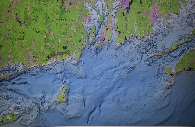
Maps showing the east & west approaches to Block Island

Order your maps

Map showing east and west approaches to Block Island

Limited number of 36" x 24" bathymetry maps showing the east & west approaches to Block Island.  The bathymetry data are colored and hill shaded  to emphasize subsea topography features.($200.00 includes S & H.  Makes a wonderful wall poster for the nautical person in your life.    The picture is suitable for framing.  Limited availability.


Carol J Charters

Captain: Paul B. Johnson Sr.

E-mail:pbjfishing@yahoo.com 

Cell: 401-207-6947 

Online Booking Calendar

Subscribe to the RI Fishing Report
I have read and agree to the Privacy Policy


Fishing, Lighthouse Cruises, Sightseeing, Sunset Cruises and Ash Burial at Sea

Home  |    RI Fishing Rates    |   Fishing RI Photos   |   Map  |  Contact Us

© 2011 - 2024 Copyright Carol J Charters  All rights reserved

Web Design by KaSondera